Have you ever been to the ‘Top of Allegheny’? It has always sounded mysterious and mystical, like something only a few have done. This ‘Top’ is not usually on a top five list anywhere. But it’s always fun to go to the top of anything, right? The charts. The college football rankings. Everything, except maybe a ferris wheel or roller coaster incline, if you’re not inclined to heights.
What is the Top of Allegheny, as it is locally referred to? Well, it was one of many in a series of high ground American Civil War encampments coveted by both sides of the conflict. Inevitable and fierce battles were fought over for the control of these high visibility posts. Why did Perry, who is taking on Pocahontas County, take himself all the way up there? The Battle for Camp Allegheny was fought on December 13th, 1861. When searching for an outdoor activity for this month’s blog, that discovery became the tipping point of the Top of Allegheny visit–to see just a bit of what the experience could have been like for the soldiers up there.
For those who like to use their imaginations to time travel, either for a lot or just a little, Camp Allegheny is a perfect place to go. It is accessible only by a dirt road. Well, actually by multiple dirt roads, but we’ll get into that later. Why not now, you say?! Okay!
Great! But first, the pattern your guide Perry has established continues in this edition of the blog. Apparently the penchant for proffering advice in the form of ‘Do as I say, not as I do’ remains unvarying. Both fortunately and unfortunately, Pocahontas County, in wild and wonderful West Virginia is indeed a wildly different place from today’s norm of blanketed area cell service. And if you’re not careful, mistakes can be made. In Pocahontas County one must, to use an inaccurately paired figure of speech, ‘dial up’ an address in one’s preferred GPS platform prior to departure. And Camp Allegheny was not fully engaged as a destination, so it was back to the 1900s for a bit. The journey was quite too far into its progress to turn around once this was fully discovered. However, being a first-rate adventurer, Perry kept going! Relying on the visual memory of a digitally mapped route is not at all recommended in Pocahontas County. Thank the gods of forest fortune, this time it worked out perfectly. Life without a digital locating device was reenacted. But again our motto is, remember, always be Pre-Perry-ed! Make sure you’re all digitally set before you leave cell service, especially when going to remote locations in the winter!
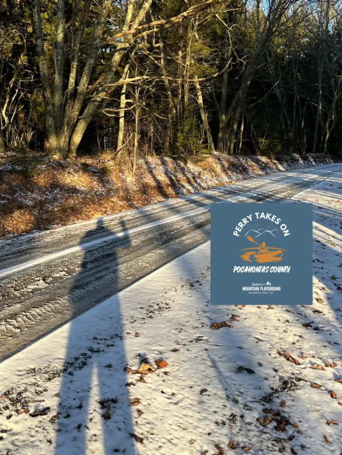
Back to the dirt road aspect. The Green Bank Road north of Arbovale off Route 28 North is the shortest distance to the Top of Allegheny, if one is traveling from the south. And it’s a one and done turn. One stays on Green Bank Road all the way to…the Top! It’s a single lane blacktop road that eventually turns into a dirt road. At that transitional juncture stands a familiar sign absolving responsibility for use in Winter, since the road is not plowed or maintained. How did Perry fare in December 2024? Not without four wheel drive. The road was in excellent condition and there was only snow in some shady stretches on the east side of the mountain. However, it’s not recommended until or unless there is a melt on after a few days at least, if there has been any snowfall.
Arrival at Camp Allegheny is not easy to miss. There is a small parking area with a clearly marked Monongahela National Forest sign. And after parking and then strolling around it was very enjoyable to be up there. The pre-gloaming light was particularly magical. And because after a long winding climb on a dirt road, one feels one has obtained access to that feeling of being somewhere remote. I didn’t have much time to explore, but used the remaining daylight to take a short walk. I found a grove reminiscent of the documentary on the Hürtgen Forest, I had recently watched. There is more to be seen, including remains of cabins in which Confederate soldiers overwintered. But that will have to be for another more temperate day.
In some research prep before the trip, I had found out that the road off Route 250 was only a couple and a half miles up to Camp Allegheny, so I drove on to find that route off the mountain. And found that, indeed, it is a much easier way to get to the Top. But the sense of satisfaction is more thorough, so I recommend Green Bank Road on the way up. Then, depart down the other side of the mountain where you will end up right at the Pocahontas and Highland County line. One could also take Old Pike Road at the junction of Route 28 and 250 near the Traveler’s Repose and Camp Bartow all the way up. It’s totally worth a leisurely loop around all of these parts. Here are places in Pocahontas County to dine or stay before or after the Top of Allegheny adventure!
Not even Perry knows where he’ll end up next month, so, please tune in again for another edition of Perry Takes on Pocahontas County!
