Trail Highlights You Can’t Miss in the Snowshoe Highlands Ride Center
Pocahontas County is home to West Virginia’s first International Mountain Bicycling Association (IMBA) Ride Center, the Snowshoe Highlands Ride Center. With 450 miles of mountain biking terrain, riders can test their skills on everything from smooth, confidence-building rollers to technical singletrack descents. Explore these trail highlights from each of the major trail systems within the Snowshoe Highlands Ride Center.
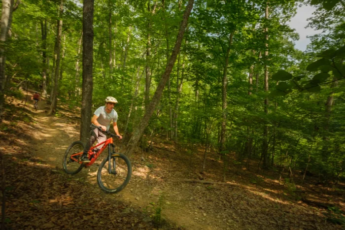
Have You Been Mountain Biking in the Region?
Help support mountain biking in West Virginia by taking a quick 15-minute survey about your experience in the Snowshoe Highlands Ride Center. Participants will be entered to win a 2026 Snowshoe Bike Park season pass or a Snowshoe Highlands Ride Center prize pack.
Cranberry Backcountry
Location: Hillsboro
Kennison Mountain Trail
Distance: 10 miles
Difficulty: Black
For a true backcountry experience complete with primitive singletrack, roots and rock gardens, ride the Kennison Mountain Trail. Winding through deep pine forest with lush ferns and moss-covered ground, this physically demanding ride finishes with a scenic descent to the Cranberry River. The trail is best ridden from the top of Route 39, heading northwest toward the river.
South Fork Trail
Distance: 2 miles
Difficulty: Blue
Beginning on an old logging grade before transitioning into singletrack, the South Fork Trail becomes more technical as it progresses. Riders will encounter multiple gully crossings that require careful line choices. Access the trail from the Kennison Mountain Trail and ride it as a shuttle route or pair it with a five-mile road ride back to the trailhead.
Cowpasture Trail
Distance: 6 miles
Difficulty: Green
Take a scenic ride through varied terrain with occasional openings into grassy meadows on the Cowpasture Trail. Along the way, pass remnants of the Mill Point Federal Prison Camp, which operated from the 1930s through the 1950s. Historical signage highlights the camp’s minimal-security design, described as a “prison without walls.” The trail is often combined with a short pedal along Forest Service Road 102 for a beginner-friendly loop.
Gauley Base Trails
Location: Slaty Fork
Roaring Run Trail
Distance: 1 mile
Difficulty: Blue
The Roaring Run Trail offers a quick and fun warm-up lap beginning at the Gauley Base parking area. The flowy singletrack follows Roaring Run Creek before transitioning into more technical sections with roots and rocks. Riders can access the trailhead via a one-mile pedal up Mine Road.
Green Bank Observatory
Location: Green Bank
Brant Hill, Brant Canyon & Deer Creek Trails
Distance: 1 mile
Difficulty: Blue
This fast-paced combination begins with a descent down Brant Hill, followed by a steep climb up Brant Canyon and another speedy descent toward Deer Creek. Together, these trails showcase some of the best singletrack at the Green Bank Observatory. From Hannah Run Road, riders can return to the parking area or continue exploring the observatory campus.
JC Junction
Distance: 1 mile
Difficulty: Green
Build confidence on the mildly technical terrain of JC Junction. This flat, lowland trail includes occasional root sections and connects with the Langston Trail before ending near the iconic Green Bank Telescope, the largest fully steerable radio telescope in the world.
Monday Lick Trail System
Location: Marlinton
Lens Ridge Trail
Distance: 5 miles
Difficulty: Black
Lens Ridge Trail delivers a well-rounded ride with high speeds, jumps and technical rocky sections. Lower sections of the trail feature exposed riding and tight switchbacks, offering a great progression opportunity for riders advancing from Blue to Black trails.
Stillhouse Trail and Sunday Lick Trail
Distance: 5 miles
Difficulty: Blue
This intermediate singletrack can be ridden in both directions, though most riders choose to descend from the top. The route combines scenic rock overhangs with flowing trail sections before finishing near the Greenbrier River — a perfect spot to cool off after a ride!
River Warm-Up East
Distance: 0.3 miles
Difficulty: Green
Aptly named, River Warm-Up East is a short beginner loop that serves as an easy introduction to the Monday Lick Trail System. The trail can be ridden in either direction.
Mower Basin
Location: Huttonsville
Hawks Ridge Loop
Distance: 2 miles
Difficulty: Blue
Featuring roots and rocks to challenge riders, Hawks Ridge Loop begins on doubletrack before transitioning into technical singletrack through the woods. The trail can be ridden in either direction, and sweeping views of the Tygart Valley await at the top.
Junco Trail
Distance: 1.5 miles
Difficulty: Green
Perfect for skill development, Junco Trail offers gentle terrain with short climbs and quick descents. Riders wind through spruce forest before emerging onto an old strip mine landscape with expansive views.
Seneca State Forest
Location: Dunmore
Rich Patch Loop
Distance: 3 miles
Difficulty: Black
This moderately challenging loop features a strenuous climb to a scenic overlook above Frost, followed by a steep descent along narrow ridgeline singletrack. Multiple creek crossings add to the adventure as the trail levels out. Riders should watch for downed trees along the route.
Hilltop Trail
Distance: 1 mile
Difficulty: Blue
The Hilltop Trail provides classic intermediate singletrack ideal for skill-building. Expect several climbs and steep descents along the route.
Allegheny Trail (Laurel Run to Loop Road)
Distance: 2 miles
Difficulty: Green
Ride a section of West Virginia’s longest trail, the Allegheny Trail. This stretch from Laurel Run to Loop Road can be ridden in either direction and is commonly accessed from the Laurel Run parking area. Its smooth, flowy descent has earned it the nickname “2 Mile Smile.” Find scenic views near the top at the Appalachian Trail shelter.
Snowshoe Backcountry
Location: Snowshoe
A Headset Adjustment Trail
Distance: 0.5 miles
Difficulty: Black
Accessed via the Enchanted Forest Trail, A Headset Adjustment Trail delivers a fast and technical descent filled with large rock obstacles, roots and heavy compressions. The trail is popularly used in Snowshoe Enduro events.
Upper/Lower Beaver Dam Trail
Distance: 1.5 miles
Difficulty: Blue
Begin with scenic views from Airport Road before dropping into technical singletrack. This route is best ridden as a progression by continuing across Black Run Road into Lower Beaver Dam. Riders can climb back via Black Run Road or return to Silver Creek by gravel.
The Fingers
Distance: ~1 mile
Difficulty: Green
Located near the Powderidge area, this interconnected beginner trail network offers a unique mossy forest experience with multiple route options. The network also connects to more advanced descents for riders looking to progress their skills.
Snowshoe Bike Park
Location: Snowshoe
Rooty Pebbles Trail
Distance: 0.6 miles
Difficulty: Black
One of the newer additions to Snowshoe Bike Park, the Rooty Pebbles Trail provides a fast, technical descent on the Basin side, complete with several sizable jumps. The trail is featured in several major events, including Snowshoe Enduro races and UCI World Cup competition events.
Skyline Trail
Distance: 3 miles
Difficulty: Blue
Ride the longest top-to-bottom trail in the park, featuring continuous intermediate jumps along with berms, rollers, step-ups and step-downs. The Skyline Trail is flow-focused and easy to carry speed, so riders should always stay within their limits.
Whistle Pig Trail
Distance: 1 mile
Difficulty: Green
The Whistle Pig Trail includes flowy turns and gentle grade reversals. The slightly steeper terrain and narrower tread introduce riders to the feel of singletrack, making it ideal for building confidence or enjoying a relaxed descent.
Stonecoal Area
Location: Huttonsville
Whitmeadow Trail
Distance: 4 miles
Difficulty: Black
Ride through remote high-elevation spruce and hardwood forest on Whitmeadow Trail. Beginning with a gradual climb to a ridgeline, the route continues across rolling terrain before finishing with a long, technical descent to Shavers Fork.
Stonecoal Trail
Distance: 4 miles
Difficulty: Blue
Though primarily beginner terrain, Stonecoal Trail earns its Blue rating due to its remoteness. Riders can expect narrow corridor riding, rolling terrain and root sections. The trail is commonly ridden as a descent from Forest Road 92.
Tea Creek Area
Location: Marlinton

Tea Creek Mountain Trail
Distance: 4.5 miles
Difficulty: Black
Starting at the Tea Creek Overlook, this demanding ride climbs to 4,544 feet before descending through iconic rock gardens and high-elevation forest. The fast, continuous descent ends near Tea Creek Campground, making it a favorite shuttle ride among expert riders.
Gauley Mountain Trail
Distance: 5 miles
Difficulty: Blue
Gauley Mountain Trail receives its Blue rating due to varied terrain, rock gardens and remote access. The route gradually traverses from the Highland Scenic Highway to the Gauley Base. Ridden as an out-and-back, the trail totals approximately 10 miles of beginner-to-intermediate riding.
Williams River Trail
Distance: 3 miles
Difficulty: Green
Following an old logging grade along the Williams River, this flat and beginner-friendly trail provides easy access for anglers and casual riders alike. The route ends at the boundary of the Handley Public Hunting and Fishing Area.
Bike-Friendly Places To Visit
Pocahontas County is home to many bike-friendly shops, restaurants and lodging options that make planning a mountain biking trip easy.
Marlinton was recently named one of the 2026 International Mountain Bicycling Association Trail Towns, a national recognition highlighting communities committed to building, maintaining and celebrating trail systems. While in Marlinton, visit Greenbrier Bikes, Dirtbean Cafe and Bike Shop and Appalachian Sport for rentals, gear and tune-ups. The town also offers lodging, camping, restaurants and local businesses.
Throughout the county, bike rentals are available at Jack Horner’s Corner, Elk River Touring Center and The Ski Barn. Find your perfect base camp for mountain biking in Pocahontas County with a wide range of lodging options, then explore local dining and shopping to round out your trip.
Plan Your Next Ride
It’s time to hit the trails! Request a free Adventure Guide to start planning your next ride in Pocahontas County.
Want to see more from our team? Save our blog as a preferred source in Google